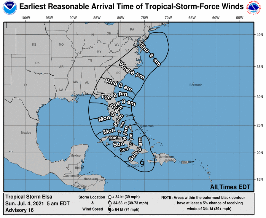
Tropical Storm Elsa Advisory Number 18
NWS National Hurricane Center Miami FL AL052021
500 PM EDT Sun Jul 04 2021
…ELSA EXPECTED TO MOVE ACROSS CUBA ON MONDAY…
SUMMARY OF 500 PM EDT…2100 UTC…INFORMATION
———————————————-
LOCATION…19.8N 77.9W
ABOUT 15 MI…20 KM W OF CABO CRUZ CUBA
ABOUT 110 MI…180 KM S OF CAMAGUEY CUBA
MAXIMUM SUSTAINED WINDS…60 MPH…95 KM/H
PRESENT MOVEMENT…NW OR 310 DEGREES AT 14 MPH…22 KM/H
MINIMUM CENTRAL PRESSURE…1009 MB…29.80 INCHES
WATCHES AND WARNINGS
——————–
CHANGES WITH THIS ADVISORY:
The Tropical Storm Watch along the west coast of Florida has been
extended northward to the Anclote River, including Tampa Bay.
A Storm Surge Watch has been issued for the west coast of Florida
from Bonita Beach northward to the Suwannee River, including Tampa
Bay.
SUMMARY OF WATCHES AND WARNINGS IN EFFECT:
A Tropical Storm Warning is in effect for…
* The Cuban provinces of Camaguey, Granma, Guantanamo, Holguin,
Las Tunas, Santiago de Cuba, Ciego de Avila, Sancti Spiritus, Villa
Clara, Cienfuegos, Matanzas, Mayabeque, and Havana
* Jamaica
* The Florida Keys from Craig Key westward to the Dry Tortugas
A Hurricane Watch is in effect for…
* The Cuban provinces of Camaguey, Granma, Guantanamo, Holguin,
Las Tunas, and Santiago de Cuba
A Storm Surge Watch is in effect for…
* West coast of Florida from Bonita Beach to the Suwannee River
A Tropical Storm Watch is in effect for…
* Cayman Brac and Little Cayman
* The Cuban province of Artemisa
* The Florida Keys from east of Craig Key to Ocean Reef
* Florida Bay
* West coast of Florida from Flamingo northward to the Anclote
River
A Tropical Storm Warning means that tropical storm conditions are
expected somewhere within the warning area.
A Hurricane Watch means that hurricane conditions are possible
within the watch area. A watch is typically issued 48 hours
before the anticipated first occurrence of tropical-storm-force
winds, conditions that make outside preparations difficult or
dangerous.
A Storm Surge Watch means there is a possibility of life-
threatening inundation, from rising water moving inland from the
coastline, in the indicated locations during the next 48 hours.
For a depiction of areas at risk, please see the National Weather
Service Storm Surge Watch/Warning Graphic, available at
hurricanes.gov.
A Tropical Storm Watch means that tropical storm conditions are
possible within the watch area.
Interests elsewhere in the Florida peninsula should monitor the
progress of Elsa. Additional watches and warnings will likely be
required tonight or early Monday.
For storm information specific to your area in the United
States, including possible inland watches and warnings, please
monitor products issued by your local National Weather Service
forecast office. For storm information specific to your area
outside of the United States, please monitor products issued by
your national meteorological service.
DISCUSSION AND OUTLOOK
———————-
At 500 PM EDT (2100 UTC), the center of Tropical Storm Elsa was
located near latitude 19.8 North, longitude 77.9 West. Elsa is
moving toward the northwest near 14 mph (22 km/h), and this
general motion is expected to continue through Monday followed by a
turn toward the north-northwest on Tuesday. On the forecast track,
Elsa will continue to move near or over eastern Cuba this
evening, and approach central Cuba tonight and early Monday. Elsa
is expected to move across central and western Cuba and head toward
the Florida Straits on Monday and pass near the Florida Keys early
Tuesday. Elsa is then forecast to move near or over portions of
the west coast of Florida on Tuesday and Wednesday.
Maximum sustained winds are near 60 mph (95 km/h) with higher gusts.
Some strengthening is expected before Elsa moves over Cuba,
followed by some weakening while the center moves over land.
Slight restrengthening is possible after Elsa moves over the
southeastern Gulf of Mexico.
Tropical-storm-force winds extend outward up to 90 miles (150 km)
from the center.
The estimated minimum central pressure is 1009 mb (29.80 inches).
HAZARDS AFFECTING LAND
———————-
Key messages for Elsa can be found in the Tropical Cyclone
Discussion under AWIPS header MIATCDAT5, WMO header WTNT45 KNHC and
on the web at
www.hurricanes.gov/graphics_at5.shtml?key_messages.
WIND: Tropical storm conditions are expected and hurricane
conditions are possible in portions of eastern and central Cuba
tonight. Tropical storm conditions are expected to begin in the
warning area in the Florida Keys late Monday. Tropical storm
conditions are possible in the watch areas in the Cayman Islands
tonight, and in the upper Florida Keys by Monday night. Tropical
Storm conditions are possible in the watch area along the west
coast of Florida beginning Monday night.
STORM SURGE: A storm surge will raise water levels above normal
tide levels by as much as the following amounts in areas of onshore
flow within the hurricane watch and warning areas…
Southern coast of Cuba…3 to 5 feet
The combination of a storm surge and the tide will cause normally
dry areas near the coast to be flooded by rising waters moving
inland from the shoreline. The water could reach the following
heights above ground somewhere in the indicated areas if the peak
surge occurs at the time of high tide…
Bonita Beach, FL to Suwannee River including Tampa Bay…2 to 4 ft
Flamingo, FL to Bonita Beach, FL…1 to 3 ft
Ocean Reef, FL to Dry Tortugas including Florida Bay…1 to 2 ft
Surge-related flooding depends on the relative timing of the surge
and the tidal cycle, and can vary greatly over short distances. For
information specific to your area, please see products issued by
your local National Weather Service forecast office.
RAINFALL: Across portions of Jamaica, storm total rainfall of 4 to 8
inches with isolated total amounts of 15 inches are expected through
today. This rain may lead to scattered flash flooding and mudslides,
some of which could be significant.
Across portions of Cuba through Monday, rainfall of 5 to 10 inches
with isolated maximum amounts of 15 inches are expected. This
will result in significant flash flooding and mudslides.
Across the Cayman Islands through Monday, rainfall of 3 to 5 inches
is expected. This rain may lead to scattered flash flooding.
Rainfall from Elsa will impact portions of the Florida Keys, Florida
Peninsula and coastal Georgia Monday through Wednesday. Amounts of 2
to 4 inches with localized maximum amounts up to 6 inches will be
possible, which may result in isolated flash, urban, and minor river
flooding.
TORNADOES: A couple of tornadoes are possible across southern
Florida Monday afternoon and Monday night into Tuesday.
SURF: Swells generated by Elsa will spread westward along the coast
of Jamaica and the southern coast of Cuba during the next day or
two. Swells will increase near the Florida Keys and south Florida
on Monday and spread northward along the west coast of Florida
Monday night and Tuesday. Please consult products from your local
weather office for more details.