

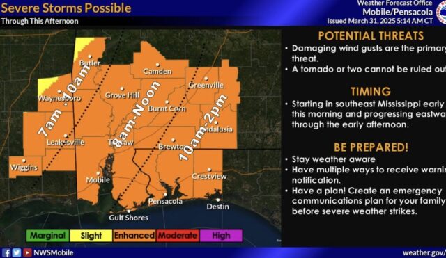
Our entire area has been upgraded to an enhanced risk for severe weather.
The most likely timing for our area is between 10 a.m. and 2 p.m.
A line of thunderstorms will move through the area during the day. Isolated to scattered damaging wind gusts are possible along the line. A tornado or two cannot be ruled out.
Flood Threat: We will also monitor the flood threat along our coastal counties where 3+ inches of rain fell yesterday.
Storms are expected to move quickly, but heavy rainfall rates and trailing storms cannot be ruled out.

